- Products
- Air Compressors & Air Tools
- Climate Control
- Compaction Equipment
- Concrete Cutting Tools & Equipment
- Concrete and Masonry
- Demolition & Excavation
- Electrical & Mechanical
- Fasteners and Anchoring Adhesives
- Floor Protection
- Generators and Welders
- Hand Tools
- Heaters
- Janitorial and Office Supplies
- Jobsite Protection
- Ladders & Storage
- Lighting & Lighting Accessories
- Man Lifts
- Material Handling Equipment
- Power Tools
- Pressure Washers & Pumps
- Safety Gear
- Safety Products
- Saws
- Surface Preparation
- SEASONAL PRODUCTS
- Rentals
- Air Compressor and Air Tool Rentals
- Climate Control Rental
- Compaction Rentals
- Concrete Equipment Rentals
- Demolition & Excavation Equipment Rentals
- Concrete Floor Grinder Rentals
- General Construction Equipment Rentals
- Generator Rentals and Welder Rentals
- Heater Rentals
- Light Tower Rentals
- Man Lift Rentals in Massachusetts and Rhode Island
- Material Handling Equipment Rentals
- Pressure Washer & Pump Rentals
- Saw Rentals in New England
- SEASONAL PRODUCTS
- Products
- Air Compressors & Air Tools
- Climate Control
- Compaction Equipment
- Concrete Cutting Tools & Equipment
- Demolition & Excavation
- Electrical & Mechanical
- Floor Protection
- Generators and Welders
- Construction Heaters
- Construction Ladders, Staging, & Storage
- Construction Lighting
- Man Lifts
- Material Handling Equipment
- Industrial Janitorial and Office Supplies
- Pressure Washers & Pumps
- Construction Safety Products
- Construction Safety Gear
- Surface Preparation
- Building Protection
- Diesel Accessories
- Zero Emissions
- Rentals
- Air Compressor and Air Tool Rentals
- Climate Control Rental
- Compaction Rentals
- Concrete Equipment Rental
- Demolition & Excavation Equipment Rental
- General Construction Equipment Rental
- Generator Rentals and Welder Rentals
- Construction Heaters Rental
- Light Tower Rentals
- Man Lift Rentals
- Material Handling Equipment Rental
- Pressure Washer & Pump Rentals
- Saw Rentals in New England
- Concrete Floor Grinder Rentals
- Zero Emissions Rentals
- Repairs & Used
- Parts
- Blog
- Services
- Resources
- About Us
- Contact Us
Sales & Rental of Construction | Industrial Equipment & Supplies


What Are the Top Firefighting Drones for Global Buyers?
Wildfires now move faster, burn hotter, and threaten communities far beyond traditional response windows. For global buyers, a Firefighting Drone is no longer a futuristic gadget. It is an operational tool for seeing smoke, heat, terrain, and changing wind conditions before crews enter danger.
Matt Sloane, a public-safety drone specialist and Skyfire Consulting executive, describes their value clearly: “Drones are a force multiplier for public safety.” That principle guides this comparison. The strongest systems combine thermal imaging, stable flight, dependable communications, weather resistance, and simple field controls. Some also support water delivery, night operations, mapping, or coordinated fleet missions. Yet specifications alone cannot prove real value. A drone that performs beautifully in a factory demonstration may struggle beside smoke, ash, gusting wind, or poor network coverage.
Real deployment details matter. Can one operator launch quickly beside a fire truck? Can the camera reveal a hot roof section through heavy haze? Does the battery survive repeated sorties without excessive downtime? Buyers should also examine training, maintenance, software support, spare parts, and local service capacity. These factors often decide whether a Firefighting Drone becomes useful equipment or expensive storage.
No platform is perfect. That is worth admitting. Budget models may offer excellent visibility but limited endurance. Premium systems may deliver remarkable sensors but demand specialist training. This guide compares leading options through a practical lens, helping emergency agencies, industrial sites, and international distributors select reliable technology for safer decisions. Performance can vary. Field testing remains essential.
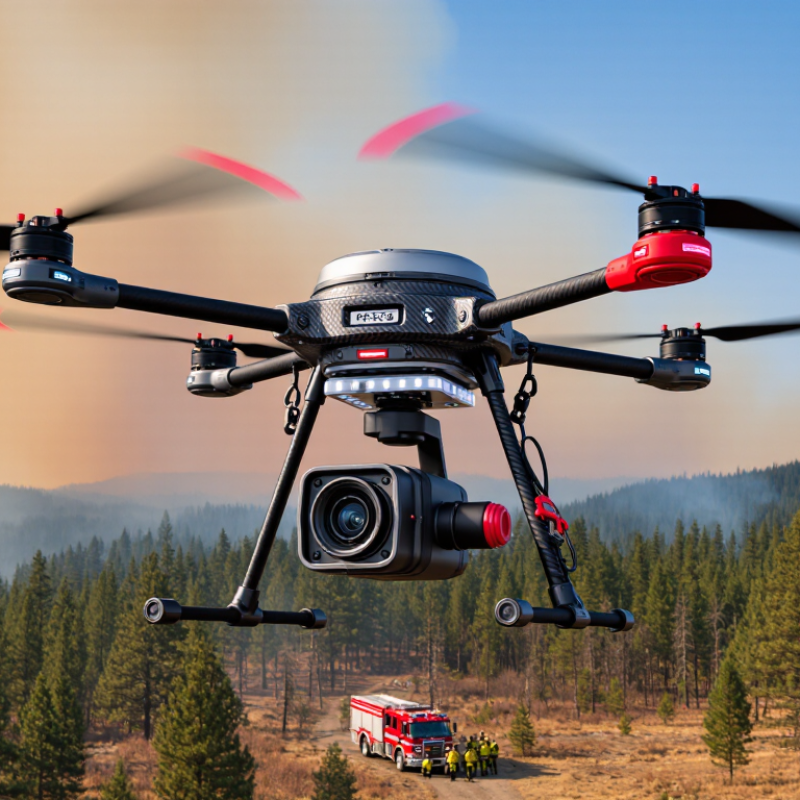
Table of Contents [Hide]
What Firefighting Drones Are and How They Support Emergency Response
What Are the Top Firefighting Drones for Global Buyers?
A firefighting drone is an aerial tool for safer, faster emergency assessment. It carries thermal cameras, visual sensors, lights, or communication equipment. Crews can inspect smoke-filled roofs without immediately sending people inside. Thermal imaging can reveal heat pockets behind walls, even during low visibility. Live video also helps commanders map flames, blocked roads, and changing wind direction. The drone does not replace firefighters. It extends their view.
The most useful systems combine stable flight, accurate positioning, strong weather resistance, and reliable data links. Some support water or suppressant delivery, but payload capacity limits flight time. Buyers should examine battery performance, sensor quality, operator training, maintenance access, and local aviation requirements. Interoperability with emergency command systems matters too. Field results can disappoint when smoke, heat, or radio interference becomes severe. That weakness deserves honest planning. A backup observation method remains essential.
Tips: Test the drone in realistic heat, darkness, and wind before an emergency. Confirm its thermal images with ground observations. Keep spare batteries protected and ready. Train more than one qualified operator. Record every flight, including mistakes, because small errors can expose larger planning gaps. Choose equipment that emergency crews can operate under pressure, not only during demonstrations. Proper permissions, privacy safeguards, and maintenance records should be part of every deployment plan.
What Are the Top Firefighting Drones for Global Buyers? - What Firefighting Drones Are and How They Support Emergency Response
| Drone Category | Primary Emergency Role | Typical Flight Endurance | Typical Payload Capacity | Common Operating Altitude | Useful Sensors or Equipment | Firefighting Support Function | Main Operational Limitation |
|---|---|---|---|---|---|---|---|
| Multirotor Reconnaissance Drone | Close-range inspection of buildings, industrial sites, forests, bridges, and incident perimeters. | Approximately 20–45 minutes per battery, depending on wind, payload, and temperature. | Approximately 1–10 kg, depending on aircraft size. | Commonly below 120 m above ground level where local aviation rules apply. | Thermal camera, visible-light zoom camera, spotlight, loudspeaker, mapping camera, and laser rangefinder. | Locates hotspots, identifies trapped or isolated people, checks roof and façade conditions, and provides live situational awareness to incident commanders. | Limited endurance and sensitivity to strong wind, heat, smoke, and turbulence; generally unsuitable for carrying large volumes of extinguishing agent. |
| Tethered Multirotor Drone | Persistent aerial observation over a fixed emergency zone. | Several hours and, in some systems, continuous operation while supplied through a ground tether. | Often approximately 2–15 kg, including cameras, lighting, communications, and other mission equipment. | Usually tens of metres to around 150 m, subject to tether length and national regulations. | Thermal imaging, high-zoom camera, floodlight, communications relay, air-quality sensors, and loudspeaker. | Maintains a stable night-and-day view of wildfire fronts, evacuation routes, large structures, and emergency staging areas. | Restricted movement, dependence on a ground vehicle or power unit, and vulnerability to obstacles, severe weather, and tether management problems. |
| Heavy-Lift Multirotor | Transport of firefighting equipment or delivery of a limited amount of water or suppressant. | Approximately 15–40 minutes with a substantial payload; less when carrying liquid or operating in strong wind. | Approximately 10–40 kg for many operational configurations. | Typically operated at low to moderate altitude near the incident area. | Thermal camera, water or suppressant tank, drop mechanism, winch, cargo hook, and obstacle-detection sensors. | Can deliver small suppressant loads to inaccessible hot spots, move medical or rescue supplies, and support operations where ground access is dangerous. | Liquid payload is limited compared with helicopters and fire engines; battery endurance, heat, wind, and take-off weight strongly affect performance. |
| Water- or Suppressant-Carrying Drone | Targeted application of water, foam, or other approved extinguishing agents. | Often approximately 10–30 minutes when carrying a liquid payload, depending on tank size and weather. | Commonly about 10–30 litres for specialized aerial delivery platforms; actual capacity varies by aircraft design. | Normally used at low altitude to improve placement accuracy and reduce drift. | Thermal camera, precision release system, flow controller, and navigation sensors. | Supports spot suppression, protects selected assets, cools limited hot spots, and reaches narrow or hazardous locations. | It cannot replace sustained hose lines, engines, or aerial tankers for large structural or wildland fires; water availability and refill logistics are critical. |
| Fixed-Wing Mapping Drone | Wide-area mapping and monitoring of wildfire boundaries, flood zones, and damaged infrastructure. | Approximately 60–180 minutes for many electric systems, depending on aircraft size and payload. | Approximately 0.5–5 kg for common survey configurations. | Usually operated at higher survey altitudes than close-range multirotors, subject to airspace restrictions. | RGB mapping camera, multispectral sensor, thermal sensor, and georeferencing equipment. | Produces orthomosaics, elevation models, perimeter maps, damage assessments, and repeat-survey data for planning and recovery. | Cannot normally hover or take off vertically without additional design features; requires suitable launch and landing space and is less effective for close inspection. |
| Hybrid VTOL Mapping Drone | Long-range reconnaissance combined with vertical take-off and landing. | Approximately 45–120 minutes, depending on flight mode, payload, and battery configuration. | Approximately 1–5 kg for many commercial survey configurations. | Variable; normally operated within approved altitude limits for unmanned aircraft. | Thermal camera, zoom camera, mapping camera, multispectral sensor, and onboard positioning system. | Surveys large or remote areas without a runway, tracks fire movement, identifies access routes, and supplies updated imagery to emergency teams. | More complex than a standard multirotor, with higher training and maintenance requirements; payload and hovering time are limited. |
| Indoor Inspection Drone | Inspection of smoke-filled, dark, damaged, or confined indoor environments. | Approximately 8–25 minutes per battery, depending on protective equipment and indoor conditions. | Usually below 1 kg, prioritizing compact size and protective cages. | Indoor operation; altitude is limited by the building structure and mission environment. | Thermal camera, low-light camera, protective cage, obstacle sensors, and compact lighting. | Checks upper floors, warehouses, tunnels, and industrial spaces before personnel enter, helping identify heat sources and structural hazards. | Short endurance, limited range, possible signal loss indoors, and reduced performance in dense smoke, extreme heat, water spray, or confined spaces. |
| Communications-Relay Drone | Extending radio, cellular, or data connectivity during infrastructure failure. | Approximately 20–60 minutes for battery-powered systems; tethered configurations can remain airborne much longer. | Usually approximately 1–10 kg, depending on the communications payload. | Selected to provide line-of-sight coverage while complying with local aviation requirements. | Radio relay, cellular relay, satellite terminal, mesh-network equipment, and emergency lighting. | Improves coordination between firefighters, search teams, command posts, and medical responders when towers or terrestrial networks are unavailable. | Coverage depends on terrain, antenna placement, spectrum authorization, weather, and the availability of a safe launch location. |
| Thermal Imaging Fire-Detection Drone | Early detection and verification of heat signatures across forests, industrial sites, utilities, and large facilities. | Approximately 25–90 minutes, depending on aircraft type and sensor payload. | Typically approximately 0.5–5 kg. | Varies according to the size of the search area, sensor resolution, and applicable airspace rules. | Radiometric thermal camera, visible-light camera, GPS, geofencing, and automated hotspot-analysis software. | Detects abnormal heat, confirms whether apparent smoke contains an active fire, and supports faster dispatch and perimeter monitoring. | Thermal readings can be affected by smoke, reflective surfaces, weather, vegetation, sensor angle, and the need for trained interpretation. |
Performance figures are typical planning ranges rather than guaranteed specifications. Actual results depend on aircraft configuration, payload, battery condition, temperature, wind, smoke, terrain, communications coverage, pilot training, and national aviation and emergency-response regulations. Firefighting drones generally supplement, rather than replace, trained personnel, fire engines, helicopters, and other established response resources.

© Copyright - Pro Tool & Supply - Site by SVM E-Marketing Solutions - Sitemap
- Privacy policy